Disaster Risk Management & Prevention (GRD)

Precision, speed and expertise in LiDAR, Surveying, Photogrammetry and Geomatics

Over 26 years supporting projects across Peru and Latin America

ISO 9001:2015 +1,200 Projects ±5 cm accuracy

Case studies

Projects we have already solved.

Three recent assignments, the ground each one faced and the technology that answered it.

Aerial view of the Peruvian Amazon canopy with low mist between the hills

Paititi Project, Instituto Inkari

Location
Cloud forest and Amazon basin, Peru
Service provided
Airborne LiDAR survey through closed canopy to detect structures hidden under the vegetation.
Solutions
Airborne LiDAR, Digital terrain models
Reinforced concrete wall under construction on a high Andean slope

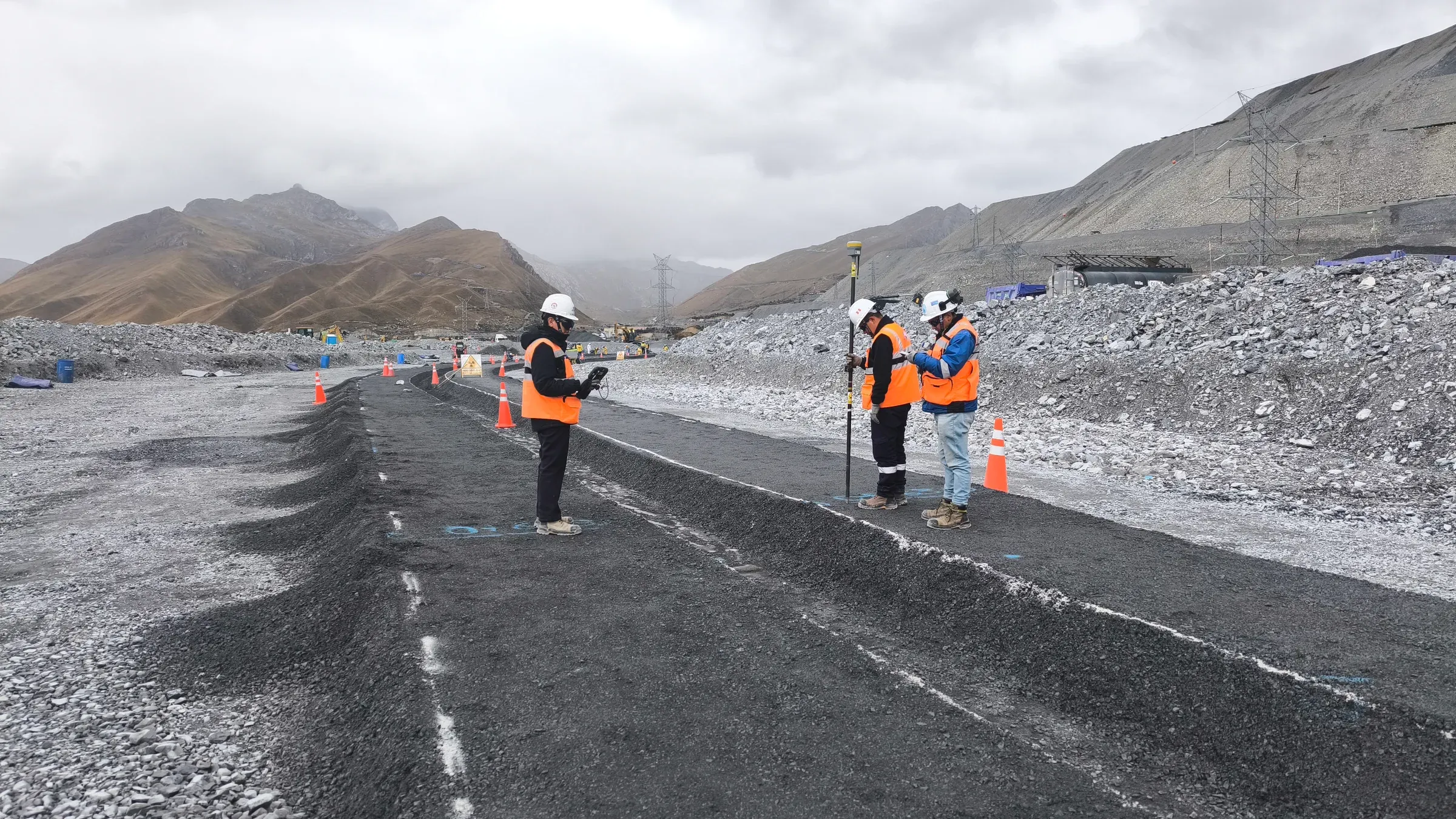
Construction quality assurance at a mining unit

Location
Junín, Peru, above 4,500 m a.s.l.
Service provided
Quality assurance of the complementary civil and electromechanical works of a dust barrier wall, on a 14x14 roster.
Solutions
Supervision, Quality assurance
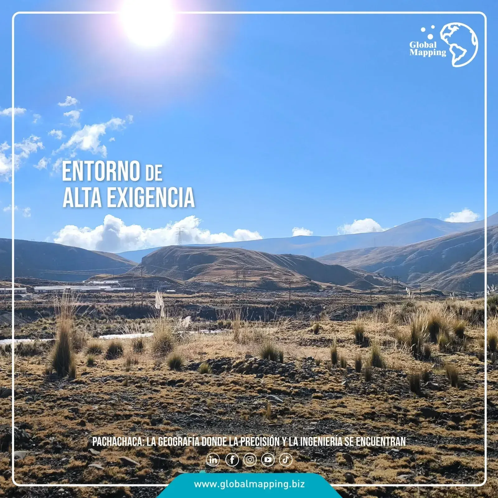
Pachachaca highland with tussock grass and transmission towers, the crew flying a LiDAR drone

LiDAR survey at Pachachaca

Location
Pachachaca, central highlands of Peru
Service provided
Two polygons surveyed with a LiDAR drone at 200 m AGL, with a GNSS base station and RTK link set up in the field.
Solutions
RPAS LiDAR, Surveying and geodesy

Read the full case

Why Global Mapping?

State-of-the-art technology, proven accuracy and multisector experience.

Multisector Experience

Multisector Experience

Mining, energy, infrastructure, cadastre and GIS

More than 26 years supporting landmark MEGAPROJECTS in Peru and Latin America. Transmission lines, road infrastructure, railways and agriculture. More than 200 satisfied clients and more than 1,200 projects back our work.

State-of-the-Art Technology

Proven Accuracy

Density of 1–100 pts/m²; accuracy ~5 cm

Vertical and horizontal accuracy on complex terrain. Rigorous QA/QC, complete reports, metadata and traceability that guarantee reliable information for critical decisions.

Certified Management

CERTIFIED MANAGEMENT

ISO 9001:2015 for Geomatics Services: Surveying and LiDAR (Light Detection and Ranging)

We run non-invasive operations and keep a culture of prevention and legal and environmental compliance.

State-of-the-Art Technology

State-of-the-Art Technology

Airborne LiDAR sensors and RGB/NIR cameras up to 150MP

RPAS drones, total stations and terrestrial scanners. LEICA airborne LiDAR scanner, gyro-stabilized platform with a frequency >2,000 kHz.

Trusted by

Over 200 leading companies in mining, energy and infrastructure

Anglo American
Barrick Gold
Poderosa
Southern Copper
Nexa
Buenaventura
Hochschild Mining
Newmont Yanacocha
Map of Peru showing completed projects

Our track record

The numbers behind our Experience

LiDAR, Surveying, Photogrammetry and Geomatics in Peru and Latin America

+1,200
Projects delivered
Mining, energy and infrastructure
+5M
Hectares surveyed
National and international coverage
+200
Satisfied clients
Leading companies in mining, energy and infrastructure

Blog

The latest from our desk

Field and office judgement: how to choose a technology, what to demand in a deliverable and what each survey taught us. Articles are in Spanish.

Our capabilities

Precision, speed and proven expertise.

Airborne LiDAR

We capture high-density point clouds (1 to 100 pts/m²) with absolute accuracy of ±5 cm vertically and horizontally. LEICA airborne LiDAR scanner at frequencies above 2,000 kHz.

Precision technology

+1,200 Projects Delivered

Over 26 years supporting energy, mining, road infrastructure, railway and agriculture projects across Peru and Latin America.

Proven experience

True Orthophoto Photogrammetry

High-resolution RGB and NIR imagery from 3 cm/pixel across 4 bands. True orthophoto with no verticality errors, for accurate multispectral analysis.

Advanced analysis

+4 Million Hectares

Surveys delivered with national and international coverage, from agriculture to transmission lines. Multi-sector projects in mining, energy and infrastructure.

Large-scale coverage

Rigorous QA/QC

Complete reports, metadata and traceability that guarantee reliable information for critical decisions. ISO 9001:2015 certified.

Quality control

+200 Satisfied Clients

From design through construction, we support complex projects with strong safety standards, expertise and non-invasive operations that respect the environment.

Regional trust

Join more than 200 satisfied clients and start your project with precision, speed and more than 26 years of proven expertise.

Infrastructure

Projects in

Infrastructure

Construction

Projects in

Construction

Mining

Projects in

Mining

Energy

Projects in

Energy

Road Infrastructure

Projects in

Road Infrastructure

Transmission Lines

Projects in

Transmission Lines

Railways

Projects in

Railways

Agriculture

Projects in

Agriculture